ALISTO
Automated Live Information for Seismic Tracking and Observation
ALISTO is a real-time earthquake monitoring and risk assessment platform powered by 120,000+ historical seismic records sourced from DOST-PHIVOLCS and WOVOdat.
It applies K-Means Clustering and Random Forest models to classify provincial risk levels — surfaced through interactive dashboards, hazard maps, and an active volcano monitoring layer.
Built with a FastAPI + PostgreSQL/PostGIS backend and a React + Leaflet.js frontend shipped as a PWA, ALISTO delivers live seismic feeds, geolocation-aware alerts, and a location-based risk assessment tool.
It also sends GPS-based SMS alerts, profiles structures with rule-based 3D mapping, and uses computer vision (YOLOv11) to detect earthquake damage.
ISA, the built-in LLM chatbot, lets users ask about risk levels, disaster preparedness, and nearby hazards in plain language — making the platform accessible beyond technical audiences.
Demo
Features
Interactive Dashboard
National and province-level analytics: earthquake frequency charts, earthquake histograms, quick summaries of risk levels, volcanic advisories, and activity trends.
Real-Time Seismic Monitoring
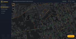
Live Leaflet.js map streaming PHIVOLCS earthquake data with magnitude markers, provincial boundary overlays, and active volcanoes with their current alert levels and advisories.
Hazard Mapping
Province-level hazard overlays visualizing active fault lines and all active volcanoes in the Philippines, helping users understand the full hazard landscape of each area.
Risk Level Classification
K-Means and Random Forest classify provinces as Low, Medium, or High risk based on 120,000+ historical seismic records and recent activity trends.
Risk Assessment
Users select their location to assess local hazard exposure — landslide, tsunami, liquefaction — and view nearest hospitals and evacuation centers.
ISA Chatbot
Intelligent Seismic Assistant — an LLM-powered chatbot answering natural-language queries about risk levels, disaster preparedness, and safety by province.
Under the Hood
Machine Learning Pipeline
120K+
Seismic Records
82
Provinces
3
Risk Levels
Data Collection
120K+ earthquake records web-scraped from DOST-PHIVOLCS with permission, then cleaned and stored for provincial-level analysis.
Feature Engineering
Province-level features extracted: total earthquakes, number of major earthquakes, nearest fault line distance, and past 30-day seismic activity windows.
K-Means Clustering
Unsupervised — no initial labels. Groups 82 provinces into 2 clusters by historical patterns, classifying 50 as Low-risk and 32 as Medium-risk.
Random Forest Classification
X = past 30 days of seismic activity; y = next 7 days. Learns temporal patterns to flag High-risk provinces — 96.6% accuracy, 86.7% precision, 73.5% recall.
Real-Time Integration
Integrated into ALISTO to dynamically update risk levels and flag high-risk provinces based on incoming seismic events.
Team
Contributors

Nicko James Barata
Full-Stack Developer, Data Analyst, AI/ML Engineer

Jealla Rose Waje
UI/UX Designer

Miguel Grant Bagtas
Backend Developer

Michael Joseph Talabo
Database Administrator